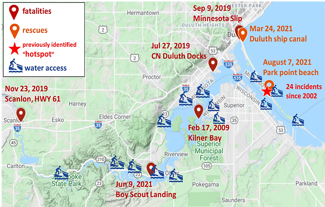
In contrast to coastal drowning, past drownings in the St. Louis River Estuary cannot be attributed to high wave energy and tend to occur under low wave, complex flow, and cold-water conditions. To date, within the St. Louis River Estuary, no effort has been made to compile past drownings and incidents, and no study has been conducted to reveal the vulnerability of locations and timings of drowning incidents. As a result, it remains unclear where the historical drownings occurred in the estuary, when they occurred, and what factors led to them. Project researchers will characterize and forecast drowning hotspots and conditions in the St. Louis River Estuary through this project. The project team, with Minnesota Sea Grant as the lead outreach organization, will use this information to raise public awareness and increase water safety among recreational users of the St. Louis River Estuary.
St. Louis County, Rescue Squad; City of Superior, Fire Department; City of Duluth, Fire Department; Wisconsin Sea Grant; City of Duluth, Planning and Economic Development; National Weather Service Forecast Office Duluth, Minnesota; U.S. Coast Guard, Marine Safety Unit Duluth; St. Louis River Alliance; Duluth-Superior Metropolitan Interstate Council, Harbor Technical Advisory Committee, Navigational Subcommittee, Harbor Safety Workgroup