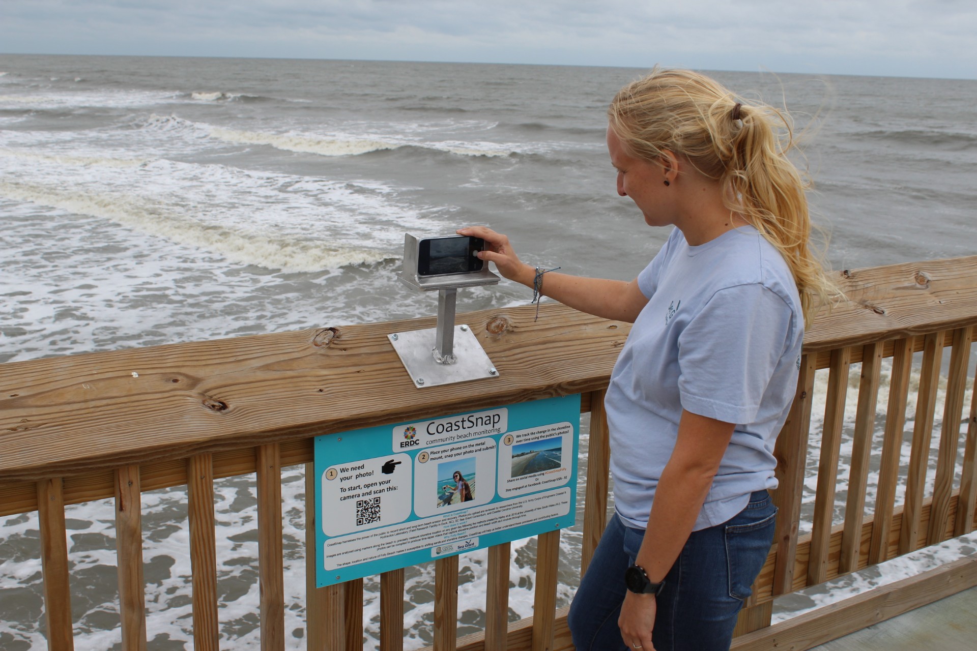
CoastSnap is a community beach monitoring program that uses cell phone photos taken by beach visitors from a specific location to track how the location’s shoreline is changing over time.
Program name
South Carolina Sea Grant Consortium
Location
North Myrtle Beach and Folly Beach, South Carolina
State
South Carolina
Partners
U.S. Army Corps of Engineers Engineer and Research Development Center (ERDC), U.S. Army Corps of Engineers (USACE), Coastal and Hydraulics Field Research Facility (in Duck, N.C.), The S.C. Sea Grant Consortium, Coastal Carolina University (CCU), Cherry Grove Fishing Pier and The City of North Myrtle Beach, and Charleston County Parks and Recreations
Project Topics
Coastal Processes/Shoreline/Erosion
Project Website